
I assume all of you know that Singapore is a city-state at the tip of Malaysia, a former British colony that became independent in 1965. It’s amazing the changes that happened in such a small period (between 1965 and now). What made the biggest difference is the opening of the container harbour, one of the biggest in Asia (if not the biggest). The harbour is huge and obstructs all the nice views to the sea.
Je suppose que vous savez tous que Singapour est une cité-État à la pointe de la Malaisie, une ancienne colonie britannique devenue indépendante en 1965. C’est incroyable les changements qui se sont produits en si peu de temps (depuis 1965). Ce qui a fait la plus grande différence, c’est l’ouverture du port à conteneurs, l’un des plus grands d’Asie (sinon le plus grand). Le port est immense et obstrue toutes les belles vues sur la mer.
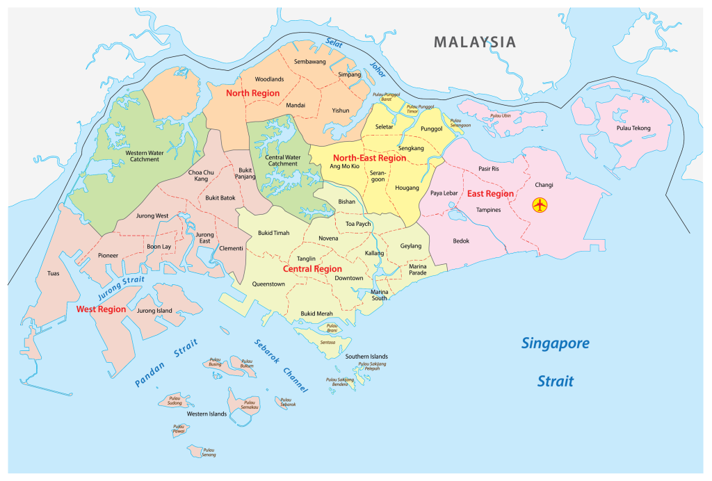
I found a map of the districts of Singapore so that it is easier to visualise where the pictures have been taken. For info, we live in Downtown district and the kids’ school is in Bukit Batok district.
J’ai trouvé une carte des quartiers de Singapour pour qu’il soit plus facile de visualiser où les photos ont été prises. Pour info, nous vivons dans le quartier Downtown et l’école pour enfants se trouve dans le quartier de Bukit Batok.
I wanted to put a map of all the biggest tourist attractions, but I can’t find one. So best is to look at Google Maps.
Je voulais mettre une carte de toutes les plus grandes attractions touristiques, mais je n’en trouve pas. Le mieux est donc de regarder Google Maps.
If you want to know more about the country, you can go to this link.
Si vous voulez en savoir plus, vous pouvez aller voir cette page (en anglais).